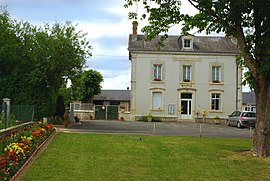
La Chapelle-Saint-Laurian
La Chapelle-Saint-Laurian | |
|---|---|
 Ratusz
| |
| Współrzędne: Współrzędne : | |
| Kraj | Francja |
| Region | Centre-Val de Loire |
| Dział | Ind |
| Dzielnica | Issoudun |
| Kanton | Levroux |
| Rząd | |
| • Burmistrz (2020–2026) | Sylvain Auger |
| Obszar 1
|
9,82 km2 ( 3,79 2) |
| Populacja
(styczeń 2019)
|
140 |
| • Gęstość | 14/km 2 (37/2) |
| Strefa czasowa | UTC+01:00 ( CET ) |
| • Lato ( DST ) | UTC+02:00 ( CEST ) |
| INSEE /Kod pocztowy |
36041 /36150 |
| Podniesienie |
125–174 m (410–571 stóp) (średnio 200 m lub 660 stóp) |
| 1 Dane z francuskiego rejestru gruntów, które wykluczają jeziora, stawy, lodowce > 1 km 2 (0,386 2 lub 247 akrów) i ujścia rzek. | |
[la ʃapɛl sɛ̃ loʁjɑ̃] La Chapelle-Saint-Laurian ( wymowa francuska: <a i=3>[ ) to gmina w departamencie Indre w środkowej Francji .
Populacja
|
|
Zobacz też
Kategorie:


