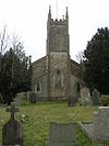
Dystrykt Mendip

Official logo of Mendip
Mendip
Shown within Somerset
Pokazana w Somerset
Suwerenne państwo Zjednoczone Królestwo
Kraj składowy Anglia
Region Południowo-zachodnia Anglia
Hrabstwo ceremonialne Somerset
Siedziba administratora Sheptona Malleta
Utworzony 1 kwietnia 1974 r
Rząd
• Typ Dzielnica niemetropolitalna
• Lider Ros Wyke
• Rada Liberalni Demokraci
Posłowie : James Heappey ( konserwatysta ), David Warburton (przeciw)
Obszar
• Całkowity 285,50 mil kwadratowych (739,44 km2 )
Populacja
 (2021)
• Całkowity 116 089 ( miejsce 207. )
Strefa czasowa UTC0 ( GMT )
• Lato ( DST ) UTC+1 ( BST )
Kod pocztowy
Numer kierunkowy 01749
Strona internetowa http://www.mendip.gov.uk/
Odwzoruj wszystkie współrzędne za pomocą: OpenStreetMap  
Pobierz współrzędne jako: KML

Mendip to lokalna dzielnica rządowa Somerset w Anglii. Okręg obejmuje w dużej mierze wiejski obszar o powierzchni 285 mil kwadratowych (738 km 2 ) z populacją około 112 500, rozciągający się od granicy Wiltshire na wschodzie do części Somerset Levels na zachodzie. Dzielnica bierze swoją nazwę od wzgórz Mendip , które leżą w jej północno-zachodniej części. Centrum administracyjnym powiatu jest Shepton Mallet , ale największym miastem (trzykrotnie większym od Shepton Mallet) jest Frome .

Okręg został utworzony 1 kwietnia 1974 r. Na mocy ustawy o samorządzie lokalnym z 1972 r . W wyniku połączenia gmin Glastonbury i Wells , wraz z dzielnicami miejskimi Frome , Shepton Mallet , Street i Frome Rural District , Shepton Mallet Rural District , Wells Rural Okręg , część okręgu wiejskiego Axbridge i część okręgu wiejskiego Clutton.

W dniu 1 kwietnia 2023 r. Okręg zostanie zlikwidowany i zastąpiony nowym okręgiem unitarnym dla obszaru obecnie obsługiwanego przez Radę Hrabstwa Somerset . Nowa rada będzie znana jako Somerset Council .

Toponimia

Zaproponowano kilka wyjaśnień nazwy Mendip . Jego najwcześniejszą znaną formą jest Mendepe z 1185 r. Jedna z sugestii jest taka, że ​​​​wywodzi się od średniowiecznego terminu Myne-deepes . Jednak AD Mills wywodzi swoje znaczenie od celtyckiego monith , oznaczającego górę lub wzgórze, z niepewnym drugim elementem, być może staroangielskim yppe w znaczeniu wyżyny lub płaskowyżu.

Alternatywnym wyjaśnieniem jest to, że nazwa jest spokrewniona z Mened (walijski mynydd ), brytyjskim terminem oznaczającym wyżynne wrzosowiska. Przyrostek może być skrótem anglosaskiego chmielu , oznaczającego dolinę. Możliwe dalsze znaczenia zostały zidentyfikowane. Pierwszym z nich jest „kamienny dół” z celtyckich meyn i dyppa w odniesieniu do zawalonych systemów jaskiń Cheddar . Drugi to „Mighty and Awesome” ze staroangielskiego moen i deop .

Zarządzanie

Okręg podlega jurysdykcji Rady Okręgowej Mendip. Począwszy od wyborów lokalnych w 2019 r. Rada przeszła na stan Brak ogólnej kontroli.

Impreza Siedzenia Zysk/strata netto
Liberalny Demokrata 22 +11
Konserwatywny 10 -22
Zielony 10 +7
Niezależny 5 +4

Od marca 2022 r. Rada liczy 23 Liberalnych Demokratów, 12 Konserwatystów, 10 Zielonych i 2 Niezależnych

Zniesienie

W dniu 1 kwietnia 2023 r. Rada zostanie zniesiona i zastąpiona nową jednolitą władzą dla obszaru obecnie obsługiwanego przez Radę Hrabstwa Somerset . Nowa rada będzie znana jako Somerset Council . Wybory do nowej rady odbyły się w maju 2022 r., Działając wraz z Mendip i innymi radami aż do ich zniesienia w kwietniu 2023 r.

Osady

Pięć głównych osad w Mendip to:

Frome, Glastonbury i Shepton Mallet to jedyne miasta w dystrykcie, ponieważ Wells ma status miasta, a Street zachowała status wioski pomimo populacji przekraczającej 11 000.

Inne wsie i osady to:

Parafie

Obraz Nazwa Status Populacja Były samorząd lokalny Współrzędne ref
Gray stone building with square tower at left hand end. Foreground includes grass area with gravestones, taken over the top of metal railings. Ashwicka Cywilnej parafii 1352 Okręg wiejski Shepton Mallet
Brown stone building with square tower at the left hand end. In the foreground is a grass area with gravestones. Baltonsborough Cywilnej parafii 864 Okręg wiejski Wells
A row of whitewashed buildings on the left with climbing plants. Small flower filled gardens separate them from a stone wall fronting a road. Batcombe Cywilnej parafii 439 Okręg wiejski Shepton Mallet
Street scene showing brown stone houses with tiled roofs. Several parked cars in the road. Beckingtona Cywilnej parafii 983 Okręg wiejski Frome
Yellow stone building with prominent square tower. Trees to left and right of the path leading to the building. Berkley Cywilnej parafii 344 Okręg wiejski Frome
Stone three stage square tower surmounted by a flag pole. To the right are trees and in the foreground grass. Binegar Cywilnej parafii 313 Okręg wiejski Shepton Mallet
Street scene showing grey stone houses on the left of a road with a few cars. Bucklanda Dinhama Cywilnej parafii 381 Okręg wiejski Frome
Grassy area with trees in the foreground and a terrace of stone houses, one white fronted, in the background Butleigh Cywilnej parafii 823 Okręg wiejski Wells
Stone two bay building with prominent ornamental tower behind Chewtona Mendipa Cywilnej parafii 585 Okręg wiejski Wells
Street scene with stone cross on three tier plinth to the left of the road. In the background is a white walled building. Chilcompton Cywilnej parafii 2062 Okręg wiejski Clutton
Stone building with prominent square tower at near end. In the foreground are gravestones and trees to the left and right. Coleforda Cywilnej parafii 2313 Okręg wiejski Frome
Stone building with arched porchway. Prominent square tower to the left hand end of building. In the foreground gravestones and crosses on grass. Cranmore'a Cywilnej parafii 667 Okręg wiejski Shepton Mallet
Water flowing through a channel and over a weir between a building and a wall. Vegetation on both sides of the water. Croscombe Cywilnej parafii 603 Okręg wiejski Shepton Mallet
Yellow stone building with central square tower, Foreground is paths through green grass. oszuści Cywilnej parafii 725 Okręg wiejski Shepton Mallet
Gray stone building with two arched porch entrance doors. Separated from road by stone wall. Dołowanie Cywilnej parafii 618 Okręg wiejski Shepton Mallet
Stone building with square tower to left hand end. Foreground shows gravestones in grass area. East Pennard Cywilnej parafii 348 Okręg wiejski Shepton Mallet
Whitewashed building with square tower. Emborough Cywilnej parafii 148 Okręg wiejski Shepton Mallet
Street scene. Stone cross on a pillar rising from 5 step plinth. Iron lampost left and right of the road are stone terraced houses. Zawsze Cywilnej parafii 2334 Okręg wiejski Shepton Mallet
Street scene. Buildings to left and right of narrow road. Frome Miasto 26203
Okręg wiejski Frome Okręg miejski Frome
Red roofs of multiple houses, with some larger white roofs at the far side. Surrounded by trees and grren fields on all sides. Hills on the horizon. Glastonbury Miasto 8932 Gmina miejska Glastonbury
Stone building at the end of narrow lane with water filled ditches on either side. Surrounded by fields and trees. Godney Cywilnej parafii 237 Okręg wiejski Wells
Stone two arch bridge over water Wielki Wiąz Cywilnej parafii 171 Okręg wiejski Frome
Stone building with arched windows. Prominent square tower to the right hand end. In the foreground are gravestones in grassy area. Hemingtona Cywilnej parafii 640 Okręg wiejski Frome
Street scene. Road junction with red stop sign. Two cars. The sides of the roads are stone walls with large trees showing above them. Holcombe'a Cywilnej parafii 947 Okręg wiejski Shepton Mallet
Stone building with old metal sign above the door saying Old Post Office, red post box set into the wall and to the left an old blue telephone box. The door is below the level of the road and separated by metal railings. Hanging baskets of flowers on the front of the building. Kilmersdon Cywilnej parafii 541 Okręg wiejski Frome
Gray stone building with square tower at left hand end. In the foreground are gravestones on grass. Lamyatt Cywilnej parafii 183 Okręg wiejski Shepton Mallet
Street scene showing a road unction with parked cars. On the left and right are stone houses with trees and fields in the distance. Leigh-on-Mendip Cywilnej parafii 514 Okręg wiejski Frome
Stone building with square tower at left hand end. In the foreground are trees and gravestones. Littona Cywilnej parafii 240 Okręg wiejski Clutton
Cast iron pump with its own tiled roof. Behind are two stone built thatched cottages. Lullingtona Cywilnej parafii 162 Okręg wiejski Frome
Small shop with white surrounds to the windows set in the right hand building of a terrace. Lydford-on-Fosse Cywilnej parafii 511 Okręg wiejski Shepton Mallet
Yellow stone building with tiled roof and arched doorway. Meare Cywilnej parafii 1304 Okręg wiejski Wells
Street of grey stone houses. The church tower can be seen n the background Melsy Cywilnej parafii 638 Okręg wiejski Frome
Stone church tower with flag pole. In the foreground are gravestones on grass. Północny Wootton Cywilnej parafii 317 Okręg wiejski Wells
White fronted building with black beams prominent. Over the door is a sign saying The George Inn, Wadworths. Norton St Philip Cywilnej parafii 858 Okręg wiejski Frome
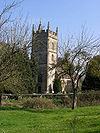
Ruined stone castle with round towers at each corner. Zakonnica Cywilnej parafii 844 Okręg wiejski Frome
Long stone building with buttressed walls and red tiled roof. Piltona Cywilnej parafii 998 Okręg wiejski Shepton Mallet
Large area of green grass with stone farm buildings behind. In the centre is a small thatched wooden building. Pridy Cywilnej parafii 624 Okręg wiejski Wells
Stone building with prominent square tower. Surrounded by trees and with green grass area in the foreground separated from the building by a stone wall. Pylle Cywilnej parafii 160 Okręg wiejski Shepton Mallet
Street scene. Triangular area of grass with village sign on wooden post and stone cross behind. Stone houses with tiled roofs n the background. Jechał Cywilnej parafii 1025 Okręg wiejski Frome
Stone building with square three stage tower at the left hand end. Trees to the right hand gravestones in front. Rodneya Stoke'a Cywilnej parafii 1326 Okręg wiejski Wells
Selwood Cywilnej parafii 798 Okręg wiejski Frome
Stone buildings seen behind trees and grass area with wooden fence in the foreground. Szarfam Cywilnej parafii 130 Okręg wiejski Wells
Street scene with buildings on the left and right. In a central position is a stone arched building with a spire. Sheptona Malleta Miasto 10369 Dzielnica miejska Shepton Mallet
Stone building with square tower Wyjście St Cuthberta Cywilnej parafii 3749 Okręg wiejski Wells
Gray bstone building with square tower to the left hand end, partially obscured by tree. In the foreground is a stone wall separating the church from the road. Stoke St Michael Cywilnej parafii 926 Okręg wiejski Shepton Mallet
Stone building with square tower. Foreground is grass with gravestones. Stona Eastona Cywilnej parafii 550 Okręg wiejski Clutton
Gray stone building with square tower. Foreground is grass with gravestones. Stratton nad Fosse Cywilnej parafii 1108 Okręg wiejski Shepton Mallet
Paved shopping street with shops on either side. Green bollards Ulica Cywilnej parafii 11805 Dzielnica miejska ul
Stone arched bridge with wooden handrail over river. Tellisforda Cywilnej parafii 182 Okręg wiejski Frome
Street scene. Red telephone box and telegraph pole. Stone buildings around road junction. Trudoxhill Cywilnej parafii 423 Okręg wiejski Frome
Stone building with tower beyond field and stone wall. Upton Noble Cywilnej parafii 128 Okręg wiejski Frome
White circular building with three windows, surrounded by vegetation. Waltona Cywilnej parafii 1106 Okręg wiejski Wells
Street scene. Houses to left and right of road junction. Wanstrow Cywilnej parafii 489 Okręg wiejski Frome
People at coloured market stalls. Surrounding are houses with the towers of the cathedral visible behind. Studnie Miasto 10536 Gmina miejska Wells
Yellow stone building with red tiled roof and square tower with short spire. Foreground is grass with gravestones. Westa Bradleya Cywilnej parafii 277 Okręg wiejski Shepton Mallet
Gray stone building with arched windows and square tower. Foreground is grass with gravestones. Westa Pennarda Cywilnej parafii 670 Okręg wiejski Wells
Stone building with square tower partially obscured by tree. Westbury Cywilnej parafii 801 Okręg wiejski Wells
Stone building with archway through it for the road. Steps to wooden doorway on the first floor. Whatley Cywilnej parafii 245 Okręg wiejski Frome
A row of cottages, partially obscured by vegetation. In the background is the bell tower of a much large building. Klasztor Witham Cywilnej parafii 399 Okręg wiejski Frome
Two bay building with square tower with spirelet. In the foreground are gravestones in a grassy area. Wookey Cywilnej parafii 1311 Okręg wiejski Wells

Transport

Główne drogi

  • A37 z Bristolu do Yeovil
  • A361 z autostrady M5 do Frome
  • A371 z Weston-super-Mare do Wincanton
  • A39 z Bath do Bridgwater

Szyny kolejowe

Stacja kolejowa

Kolej East Somerset

Stacja kolejowa

obsługiwane przez East Somerset Railway .

Edukacja

Szkoły powiatowe (te, które nie są niezależne ) w pięciu niemetropolitalnych okręgach hrabstwa są obsługiwane przez Radę Hrabstwa Somerset .

Aby uzyskać pełną listę szkół, zobacz: Lista szkół w Somerset

Zobacz też

Linki zewnętrzne